
Summary: We’re finally sailing after a little bit of everything.
Position: 04 46.26 S 092 53.73 W
COG: 202 degrees m
24 hour distance: 155 nm
Average speed 6.45 kts
Distance to go to Hiva Oa: 2,762 nm
Day 2 Summary: Our winds died down yesterday afternoon as we were back to motoring with flappy sails and no more favorable current (as far as we could tell). Fortunately the multi-directional waves subsided and the seas evened out making for a comfortable, if not slow, afternoon. This allowed the girls to make progress on some schoolwork and for us to catch some good afternoon naps. The sky cleared giving us a beautiful blue afternoon, but clouds were looming on the horizon.
Later into the evening we were able to deploy more sails to try to take advantage of wind with a real direction. After midnight we put out the spinnaker again and were able to get back over 7 kts of speed, whereas we had been in the low 6s most of the day. Just after 3 am, Satin alerted Dave and Camille to increasing wind speeds and an approaching squall. We leapt into action and got the spinnaker down (not without some difficultly and some rope burn) before we were hit with even strong wind and rain. You can see the sharp course correction on our tracking map while we managed the sails.
For the rest of the evening into early morning we motored again through constant rain and variable winds. Finally around 9 am the winds picked up from a steady N direction around the small low pressure bubble we’ve been skirting. Now we are sailing at 8 kts, close-hauled in 18-22 kts of wind with the engine finally shut down. We’re not sure how long this will keep up, but it looks like we’ll be moving SW/W with this current system and expect cloudy weather and rains until at least Saturday. It’s stuffy down below with the windows closed, but at least we’ve finally found some wind.
Wildlife Sightings: Tuesday afternoon we caught a nice 3.5 foot Wahoo but turned him loose because our refrigerator and freezer are packed full and we didn’t think we could eat it all for dinner. Playful dolphins 1/2 mile off the bow breaching and leaping about. Many seabirds keeping us company in the rain. A small flying fish in the cockpit this morning.
Day 1 Passage Update to Hiva Oa
We are going to try to post daily passage notes via our satellite email as we make our way from the Galapagos to Hiva Oa. This is a low bandwidth connection so we can’t add pretty pictures and can’t respond to comments until we arrive, but we hope you enjoy these updates.
Summary: Calm seas and nice afternoon and evening winds helped speed us out of the Galapagos. Now trying to escape light winds and rolly seas to get to the trades.
Position: 02 26.83 S 097 07.38 W
COG: 202 degrees m (has been 220, re-adjusting for tomorrow’s predicted winds)
22 hour distance: 153 nm
Average speed 6.95 kts
Distance to go to Hiva Oa: 2,831 nm as the frigate bird flies
Day 1 Summary: We checked out and bought some final supplies and souvenirs Monday morning (best find: cranberry juice). Nice afternoon winds from the aft beam allowed us to fly with the main and asymmetrical spinnaker until nearly midnight, with motor assist to charge batteries and make water. This morning we have light and variable winds with waves from multiple directions creating rolly conditions. Lots of rain washing deck clean. Kyra bumped her head and has been icing it, moving around is challenging. Based on forecasts, it looks like we have at least another day under power to reach better winds. We can’t wait.
Wildlife sighting: 2 squid on deck were returned to the ocean (Camille says #savethesquid). 2 whales of some sort passed by this morning. A giant moth.
The Wreck of Los Llanitos

After a most excellent Christmas and New Years in Barra Navidad, we thought New Year’s Day would be a perfect day to get some exercise by taking a hike to get a better view of the Los Llanitos shipwreck just around the point from the marina. We saw the wreck when we arrived on December 23rd and were interested in getting a better view. The 731-foot-long bulk tanker left Manzanillo to ride out hurricane Patricia at sea. However, fate had other plans in store for the ship, and it was quickly overcome by large seas and 200 mph winds and washed up on the shore on October 23rd. The oil and diesel fuel it carried were soon salvaged to prevent marine contamination. Meanwhile, the Mexican government is still trying to decide if removing the remains of the ship would be better or worse for the environment.
A day earlier on New Year’s Eve, I attempted a drone reconnaissance flight from the beach around the other side of the steep, rocky Punta Graham which claimed the ship. Due to a combination of software problems and the distance involved, I was unable to get a visual of the wreck. An examination of Google Maps satellite data and aerial drone views showed that it should be possible to reach the peak above the wreck if the roads were still passable.
I was running out of daylight to finish some varnish work and cool off at the pool, so I recruited Satin along with Jake from Sassafrass to join me on a hike the following morning. The shortest route according to Google appeared to be a road heading up and over the ridge from the marina side of the hills. We walked up the steep resort roads toward the ridge. Incidentally, the miles of roads around the resort and adjoining golf course are paved with millions of bow-tie shaped paving stones. We marveled at the amount of labor that must have gone into manually laying these stones.

Unfortunately, we found only dense jungle and steep drainage culverts where we were hoping to find the road. This meant we had to continue over the lower rise and back down to the golf course to attempt to pick up a different road up a neighboring ridge. We were fortunate to pass by the water storage area, whose clearing provided an amazing 270-degree view of Barra Navidad and the Barra Lagoon.
I had scouted our next target road the previous day and knew where it headed up from one of the golf club roads. We found it again easily, and started our way up amongst the overgrown weeds and scuttling lizards who were not especially fond of our intrusion. Things were looking good as we came to a meeting of ridges and forks in the road, including one that continued in the right direction. The more overgrown trees provided much-needed shade, but also more hungry mosquitos and noseeums. We continued on the mostly gentle grade for about another mile when we caught sight of a cell tower and navigation light. The road we’ve been following was also the path for power lines up to these installations.
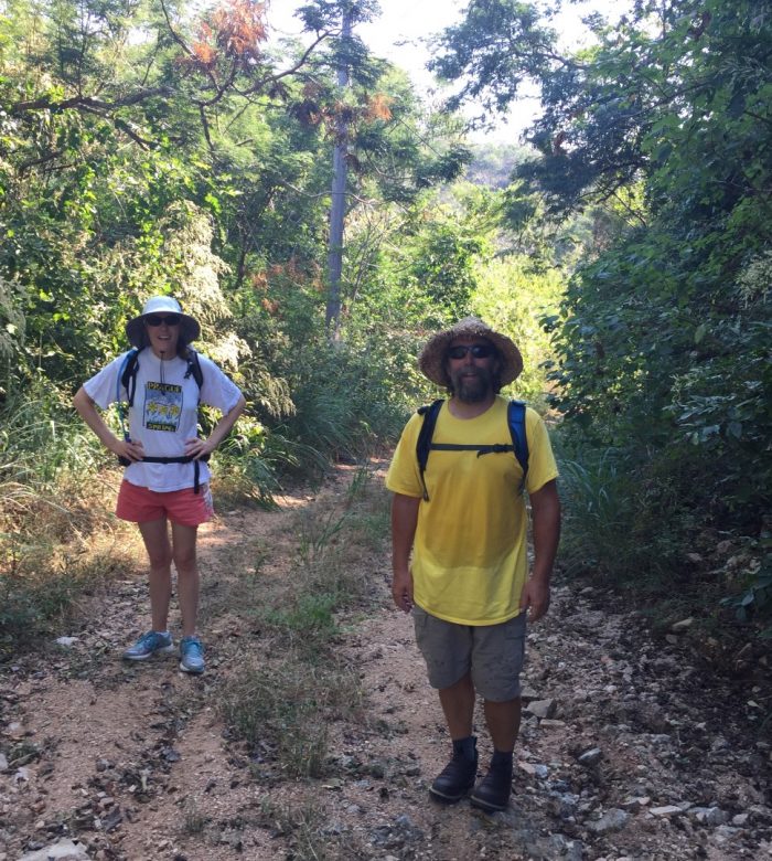
 Satin and some random buildings.


Although the vegetation grew thick around these fenced off areas, Jake spied a narrow path around the right side of the navigation light (the left side was a sheer drop-off). We carefully made our way around to find a locked and abandoned house-like structure followed by the crumbling foundation of another, presumably wooden, building which has been long-since reclaimed by nature. We speculated that it may have once been a light-keepers house from the white tile flooring that remained on what was left of the foundation. And the best part was our clear view of the wreck hundreds of feet down from the point awash in the waters against the shore.
Fortunately, the flat tiles and small clearing provided just enough room to get the Mavic Pro off the ground and down for a closer look. We heard the hoots and hollers of people checking out the wreck from pangas far below as the drone descended to the wreck. The original aft tower is long gone, consumed by the waves. As you can see, the hull is breaking apart and it seems unlikely that it will ever be removed.
Overall it was a great hike with excellent views and I would highly recommend it if you find yourself in Barra Navidad or Marina Navida. The total distance was about 6 miles round trip if you avoid the extra up-and-over path we took past the water storage facility. It’s best to start early in the morning to avoid the heat of the day and some of the insects, and you shouldn’t head out without good footwear, insect repellant, water, your camera, and maybe a few pesos in your pocket for a cold drink or snack on your way back through Culebra.
Raining in La Cruz
Good morning from beautiful Banderas Bay! We’re in the marina at La Cruz just up the bay from Puerto Vallarta. The rain has finally caught up with us, but we knew that would happen eventually as we moved south. Fortunately, it’s light and refreshing and has brought the temperature down to 73° from the high 80s. It’s nice to be at the dock again for several nights, as we had a few very rolly polly nights underway and at anchor before arriving here.

Good morning from beautiful Banderas Bay! We’re in the marina at La Cruz just up the bay from Puerto Vallarta. The rain has finally caught up with us, but we knew that would happen eventually as we moved south. Fortunately, it’s light and refreshing and has brought the temperature down to 73° from the high 80s. It’s nice to be at the dock again for several nights, as we had a few very rolly polly nights underway and at anchor before arriving here.
I’m sorry we’re a little behind on our blog post updates as we know all of you are interested in where we are, what we are seeing, and how life is going on the boat. As you might imagine, moving around from place to place and trying to keep up with schoolwork, bills at home, boat maintenance, meeting new friends, and seeing new places. It’s not all fun and games and lounging about!
La Cruz is a small fishing village that was much sleepier 10 years ago until the Marina Riveria Nayarit opened their doors (slips?) 10 years ago, bringing many more visitors to the village. We’ve already discovered a delicious Italian/pizza restaurant, German restaurant (and beer), plus the usual smattering of Mexican fare. Jess and Janet Coburn are the proprietors of Todo Vela Mexico, a small but well-stocked chandlery, with very fair prices compared to most chandleries we’ve come across, including a place in Cabo that stocked half their store from West Marine at triple the prices. In my view, this is another version of modern-day piracy. Jess is also an excellent rigger and helped me with a couple rope splices I’m learning.

While we are here we are trying to catch up on everything, including some blog posts. The girls have been trying to finish the semester and take their tests to earn some holiday vacation. We are trying to finish up teak varnish and treatments to protect our wood from the strong sun, install new dinghy wheels to make beach landings easier, get window shades made, have our laundry done, and more. As we’ve found everywhere, the marina staff is very friendly and helpful. We found some local help on the dock for our wood projects, so we don’t have to sand and clean so much. Parts and materials are 30% or more expensive here, but the lower cost of labor helps make up for it.
Tomorrow we’re moving further into the bay for several more days at Paradise Village Marina in Nuevo Vallarta. Our friends Craig and Trish Unger are flying down for the holidays and we’re excited to meet up with them for a few days and get in some fun gaming time. Please let us know what else you’d like to hear about in future posts. We hope everyone is ready for an enjoyable holiday season!
Enroute to Bahia Santa Maria
Greetings from the next leg of our Baja Ha Ha rally! Despite our late start from San Diego we arrived in Turtle Bay in just two days with a pack of boats coming in just after dawn. Most of the trip down the 313 nm was motor sailing due to light 3-5 kts winds. We sailed under main and spinnaker for about 3 hours on the second day before winds let us down again.
It was in interesting two days in Turtle Bay as local fishermen in their “panga” boats came out to offer taxi rides, garbage pickup (basura), ice (hielo), and fuel at a pricey $6/gallon. We opted to fill our four Jerry cans with 20 gallons but the credit card machine was down due to bad connectivity. We were told that 4 rallies pass through this little fishing village each year and the locals are friendly and helpful, and certainly happy for the business opportunity. The kids were let off school on Thursday and Friday to help out their families in support of the fleet and to participate in the baseball game on Thursday and beach party on Friday.
The cell tower had been down when we arrived but was fortunately fixed sometime on the morning of November 2nd. Voice and texting worked find, but data was flaky. We’ll post more with photos when we have a faster data connection. Our next stop will have no services or connectivity.
Fortunately, the wind is back today and we are sailing with spinnaker and main at 7.3 kts down the Baja coast. We had a chance to try out our new spinnaker pole for the downwind run this morning. It’s very pleasant and to be making such good time with no engine noise and mild seas. The crew is in good spirits but Camille and Kyra still need to get going with today’s schoolwork to make up for two short school days at Turtle Bay.
Fair winds until our next post!
Underway from San Diego
We are a day late leaving from San Diego on the Baja Ha Ha due to finding oil on the bottom of the windlass and not being able to tell if it had any oil or not in the gear case. We relocated from Chula Vista to Harbor Island on October 30 while Dave and Kevin set to removing and servicing the windlass. Due to the design of the anchor locker separator, it was not possible to completely remove the unit, but they cleaned and regreased the upper unit and found that the gearbox was full of oil.
Confident that we can now retrieve our anchor we are underway for Turtle Bay and to catch up with the fleet!